Many residents of western Colorado recognize the Grand Mesa as one of the dominant landmarks in the Grand Valley. It rises to over 10,000 feet in elevation and contributes to the overall beauty of our region.
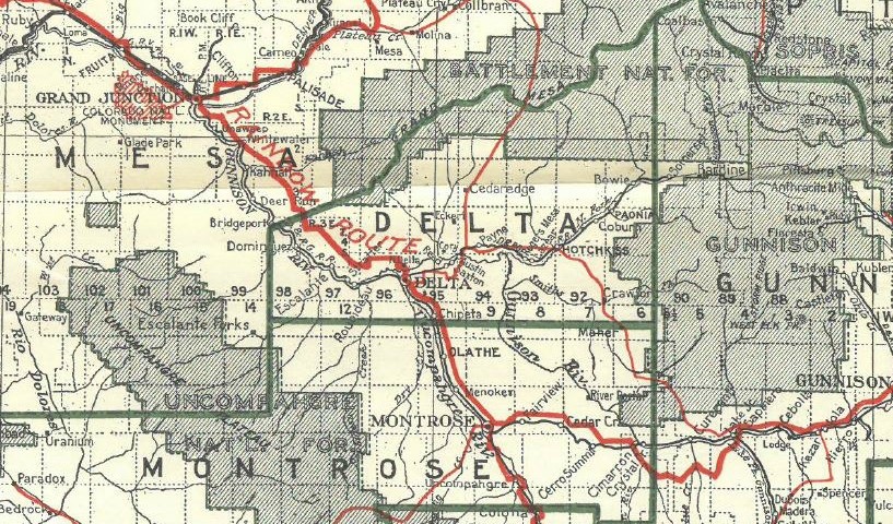
The Grand Mesa National Forest was established on March, 11 1924 but it didn’t always go by that name. In 1892 the area was set aside as the Battlement Mesa Forest Reserve, eventually becoming Battlement National Forest, which is how it appeared in the 1919 map pictured above.
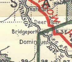
Towns and communities such as Bridgeport, Akin, Carbonera, Uranium, and Atchee also appear on maps from this time period. These places are now long gone with only fading structures and scattered artifacts to remember them by.


In a camping video of this locale, I noticed the many meadows scattered among the forested areas. Is there any evidence that Native Americans used/hunted/lived in this area before European-Americans arrived (and after)???
Hello,
Thanks for contacting Mesa County Libraries about this topic. An individual who could most exhaustively and authoritatively answer that question would be an archaeologist. However, there is online content which documents evidence of Native American presence in this area on a prehistoric and historic level. Below are the titles and respective URLs for some of those resources.
The Dominguez and Escalante Expedition
https://www.nps.gov/dino/learn/historyculture/the-dominguez-and-escalante-expedition.htm
Dolores Cave
https://coloradoencyclopedia.org/article/dolores-cave
Tabeguache Cave
https://coloradoencyclopedia.org/article/tabeguache-cave
A Reanalysis of Archaeological Materials from Roth and Luster Caves by Elizabeth Kaye Smith McDonald
https://digital.auraria.edu/work/sc/b4663966-c663-4bb8-851e-c1cb6e90e616
An Analysis of the Prehistoric and Historic Rock Art of West-central Colorado by Sally J. Cole
https://archive.org/details/analysisofprehis00cole/mode/2up
The Colorado Wickiup Project Volume II: Cultural Resources Class II Reconnaissance Inventory for the Gunnison Gulch Area of Mesa County, Colorado by Curtis Martin, Principal Investigator
Carl E. Conner and Nicole Darnell
https://dargnet.org/Publications/CWP_2.pdf
Identifying Cultural Landscapes: Archaeological Documentation and Analysis of Native American Rock Art along Proposed Prehistoric-to-Historic Trails in Mesa County, West Central Colorado by Carl Conner, Michael S. Berry, Sally J. Cole, Curtis Martin, Richard Ott, Nicole Darnell, Courtney Groff and Hannah Mills
https://dargnet.org/Publications/Mesa_Ute_Trails_Cole_RA.pdf
Additionally, there are a number of printed resources which provide similar information. If you would like more information about those printed materials, feel free to reply to this comment.