Working at libraries, particularly those with vibrant historical collections, you meet all kinds of artifact hunters. Occasionally, they let drop a hint or two about how they go about their business. While I cannot vouch for the man in Denver who claimed to be following plans for the recovery of buried treasure (supposedly passed from ancient space aliens to Native Americans), other tips gleaned from researchers might be of help.
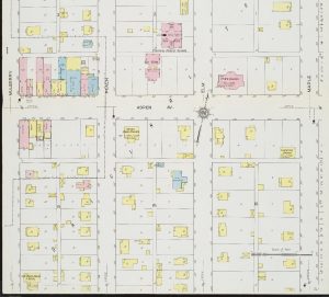
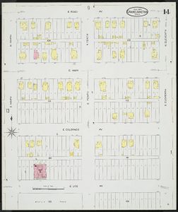
Do you live in Grand Junction or Fruita’s downtown areas in an older home? See if you can find your home using the Sanborn Fire Insurance Maps. The Sanborn Fire Insurance Company made detailed maps of buildings in many communities during the late Nineteenth and early Twentieth centuries. Today, researchers utilize these maps in order to discover the history of their home or business, or to find out about a neighborhood or town’s history. The University of Colorado at Boulder digitized many of the Sanborn’s Colorado maps, and they are available for free online.
One researcher in the Denver area uses the Sanborn maps to find out where old outhouses were located on a house, apartment building, or business’s property. Then, he digs in the location of the old outhouse. Why on earth would he do that, you say? Because not only did people do their business in an outhouse, but they also threw trash down in the pit. And people used to have more interesting trash than today. This particular scavenger collects and sells antique glass bottles that came in vibrant colors. So take a look at the Sanborns, find your old poop house, and dig away.
Another researcher utilizes the Sanborn maps in Denver to locate lots that have never been built on. Theorizing that children must have played on these vacant lots from time immemorial, he takes his metal detector out and locates old coins, watches, and many other things that children over the years have dropped. You might also take a look at the Sanborns to find such vacant lots in Grand Junction or Fruita, or look around the valley to find fields and lots that still contain sage, mormon tea, and other native plants. Chances are, these lots have never been built on, or have had a 100 years or more to regenerate native vegetation.
Prospectors around the West still dream about striking it rich. Some prospectors study old mining maps, available at institutions such as the Museums of Western Colorado and the Western History and Genealogy Department of the Denver Public Library, and compare them with modern day USGS topographical maps to try and ascertain an accurate location for old mining claims (you can view USGS topo maps in the downstairs of the Mesa County Libraries Central Branch upon our reopening, or view them online). Then, they head out and try to make money from someone’s abandoned claim.
Happy hunting…! In a safe, Coronavirus quarantine-compliant way, of course.


