
Colorado is a state with a rich history, and one of the best ways to see that reflected is in the diversity of names found in its towns, streets, natural features, and landmarks. In this new series, we’ll take a look at some of the interesting names found around Colorado and nearby areas, and explore some of their meanings and history, and share some extra fun facts and trivia. Our goal is to try to teach you something you didn’t know in every new post, so if you learned something new, be sure to leave a comment!
Geography is what defines the world around us, where we choose to settle down, and how we choose to spend our time and make a living. Colorado, of course, has some of the most striking natural geography in the world, so we decided that this first Nifty Names should focus on the topography that defines the Grand Valley.
The Grand Valley is a valley in Western Colorado and eastern Utah, primarily within Mesa County. It’s about 30 miles long and 5 miles wide, and is bound by several distinct geological features. On the east side is the Grand Mesa, on the north is the Book Cliffs, and to the southwest is the Colorado National Monument. Two rivers, the Colorado and the Gunnison, join together in Grand Junction, the largest city in the valley. Other communities include Palisade, Clifton, Orchard Mesa, Fruita, Loma, and Mack.
The Grand Mesa
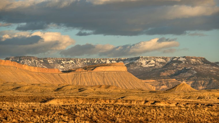
The Grand Mesa rises behind Mount Garfield at sundown [Photo By Ken Barber/Alamy]
The Grand Mesa dominates the surrounding geography and is capped by a hard layer of volcanic basalt, which makes it stand out from the surrounding sandstone cliffs. The basalt erodes much more slowly than sandstone, which is why it stands much taller than any surrounding structures. The Mesa is a bit of an oasis in the semi-arid climate of Western Colorado, with cooler temperatures and considerably more precipitation, supporting over 300 lakes and making it a popular wintertime destination for skiing and snowboarding. Most of the Grand Mesa is public land managed by the U.S. Forest Service as the Grand Mesa National Forest, making it a fantastic area for fishing, hiking, and other outdoor activities.
The Mesa’s many lakes and reservoirs are actually the primary source of irrigation and drinking water for surrounding communities, particularly downstream to Grand Junction. The north side of the Mesa drains through Plateau Creek, a tributary of the Colorado River. The south side drains to Kannah Creek, which meets with the Gunnison River to the Southwest. These two rivers meet in Grand Junction, which brings us to…
The Colorado River
The Colorado River may seem like it has a straightforward name, but there’s some interesting history behind it. You would assume that it’s called the Colorado River because its headwaters begin in Colorado, but that wasn’t always the case. Until 1921, the portion of the Colorado River from its headwaters near Estes Park to where it meets with the Green River in Utah was called the Grand River, and it only became the Colorado once those two rivers met. The name was changed in 1921 thanks to the efforts of Congressman Edward Taylor from Glenwood Springs, representing Colorado’s 4th District (at the time encompassing most of Western Colorado). Coloradoans have always been rather prideful over our state, and it bothered a lot of people that the Colorado River didn’t begin in Colorado itself. Worst of all, some even claimed that it began in Wyoming, where the comparatively longer Green River had its headwaters. In July 1921, Taylor passed a joint resolution in Congress to rename the Grand to the Colorado, and it’s stayed that way ever since. A year later, the Colorado River Compact was signed, which regulates water distribution among the seven states the Colorado passes through before it (in theory) drains into the Gulf of California. This 1922 agreement still governs the waterway today, which is the primary source of water for 40 million people in the arid Southwestern United States.
Echoes of the “Grand” River still remain along its initial path, in Grand Junction, the Grand Valley, the Grand Mesa, Grand Counties in both Colorado and Utah, Grand Lake in Colorado, and many other locations along the river. Ironically, the Grand Canyon was not named for the Grand River, but was given that name because John Wesley Powell was taken aback by the grandeur of the colorful canyons. The Colorado River just has that effect on people, it seems.
If you’re interested in recreation near the Colorado River, consider checking out one of our Colorado State Parks Passes with your Mesa County Library Card.
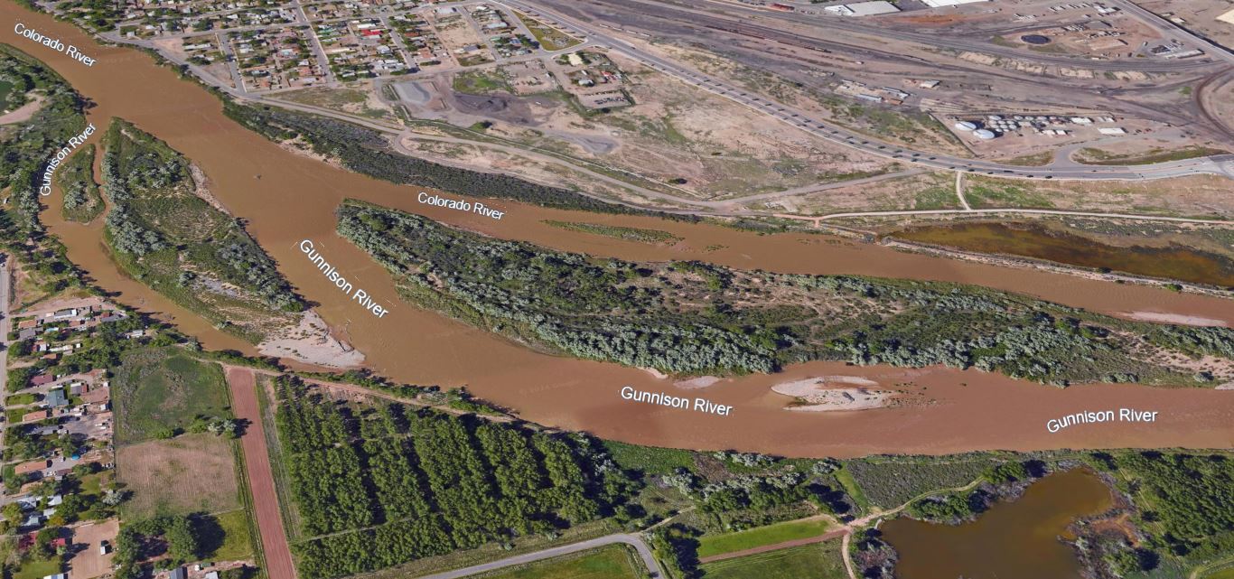
The Colorado and Gunnison Rivers meet near the 5th St. Bridge in Grand Junction. [Google Earth]
The Gunnison River
Gunnison River, County, and the city of Gunnison are all named after one man, Captain John Williams Gunnison of the U.S. Army Corps of Topographical Engineers. He had experience traveling through the western United States and had previously spent time surveying the LDS population around the Great Salt Lake. In 1853, he was sent from St. Louis to survey a route through the Rocky Mountains for the transcontinental railroad. This expedition brought him through Tomichi Valley, where the town of Gunnison was later founded. His team then traveled through the Black Canyon, named as such because its steep, narrow cliffs carved by the Gunnison River only allow for 33 minutes of direct sunlight per day in certain parts of the gorge.
Gunnison’s expedition team was killed in Central Utah on October 26, 1853 by a band of Pahvant Paiutes, who were retaliating against white settlers who killed the father of their chief. In the aftermath it was rumored, including by Gunnison’s widow, that Gunnison’s team was killed on the orders of Brigham Young, who allegedly wanted to prevent a transcontinental railroad to keep Utah free from non-Mormon settlers. There was no evidence at all to suggest that this was the case, and in fact the LDS Church explicitly desired the railroad, but the controversy was enough to push the railroad north through southern Wyoming.
Colorado National Monument
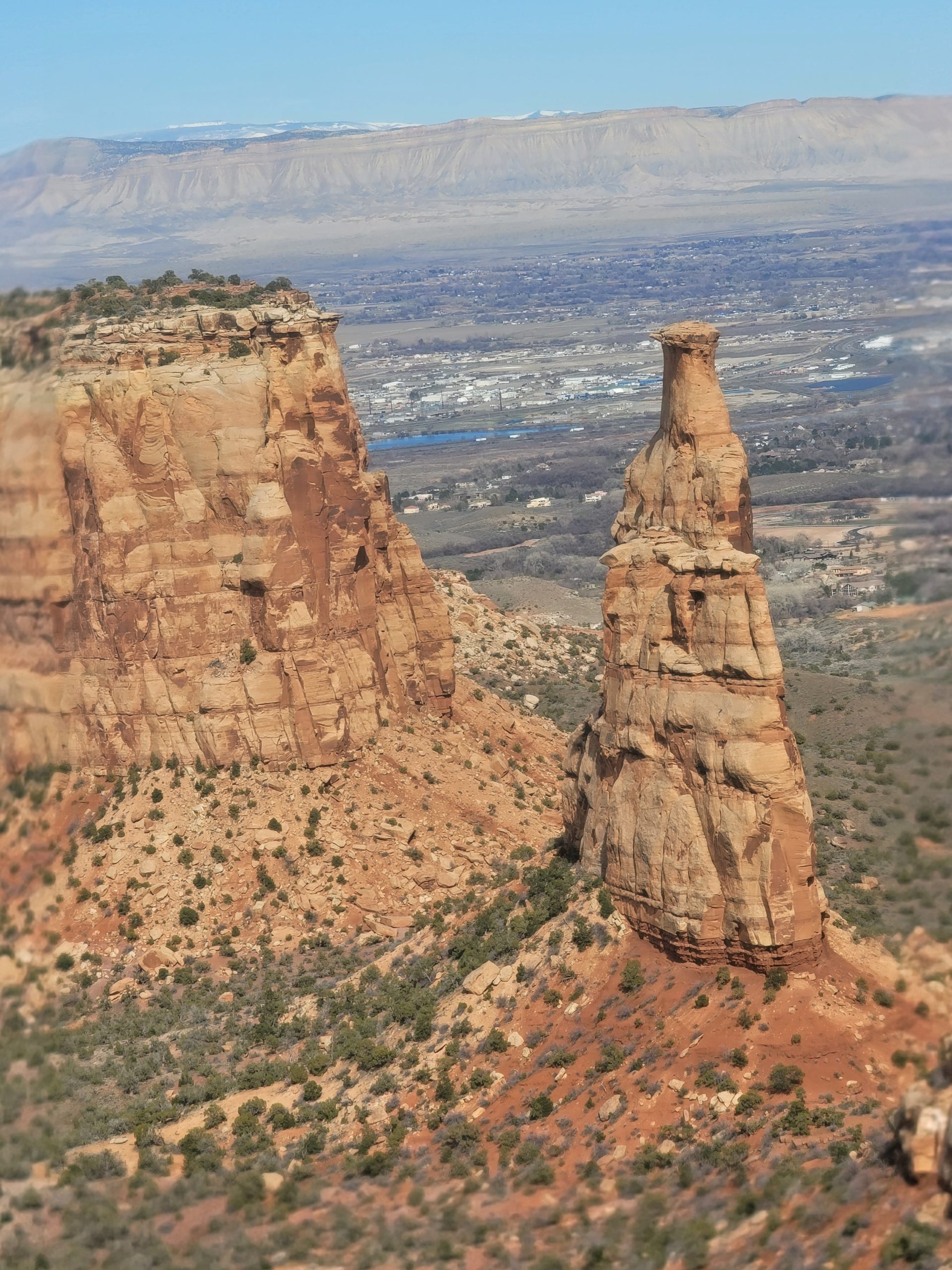
Independence Monument in the Colorado National Monument, with the Book Cliffs in the far background. [My photo]
If you’re interested in visiting the Colorado National Monument, you can check out a Colorado National Monument Patron Pass Backpack with your Mesa County Library Card. It includes binoculars, a nature journal, and activity guides
The Book Cliffs
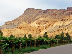
Vineyards in Palisade below Mt. Garfield [Creative Commons, photo by Don Graham]
.jpg)
Another range, called the Roan Cliffs, run parallel to the north of the Book Cliffs and are sometimes also referred to as the Book Cliffs. Roan typically refers to a color found on horse coats where white hairs are mixed evenly with other hairs on the body, producing a silvery effect and sometimes making horses appear different shades of blue or pink. The Roan Cliffs share this color and feature prominently near Parachute and Rifle, CO. They can also be seen as the darker-colored ridges peaking over the Book Cliffs in the Grand Valley.
_________________________________________
And with that, we’ve officially covered the geography of the Grand Valley. While most of this was probably familiar to any locals, we hope you learned something new! There’s a few other notable geographic features in the Grand Valley we didn’t cover this time, so please stay tuned for more. We’ll be making plenty more of these, so please share your suggestions on what we should cover next.
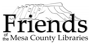
Big thanks to the Friends of Mesa County Libraries for supporting local history blogs like these. Their logo happens to be one of the best representations of the Book Cliffs for explaining why they’re named that way, so additional thanks for the visual reference.
Thumbnail photograph by Ken Barber/Alamy, Standard License.
Well done!
Thank you!